
Geomatrix Envirotech Solutions
Professional Geologists, Hydrogeologist & Environmental Scientists Providing Environmental Consulting Services

“Earth does not belong to man; man belongs to the earth”
Geomatrex Envirotech Solutions, (GES) provides comprehensive environmental
services to clients engaged in government, commercial and residential property
development.
Philosophy –
The purpose of our professional service is to interpret site conditions and
provide our clients with economical and technically sound recommendations while
integrating project requirements with the site environment.
Experience -
Established in recently, our professional staff includes environmental
scientists in the fields of geology, hydrogeology, environmental science and
the earth sciences. GES specializes in providing comprehensive services
for planning and development of real estate including Geological and Seismic Study, Hydrogeological
study, Geophysical study, Mine plan study, Ground vibration study, Petrological
& Petrographical study, Remote sensing and GIS, Photogrammetry study,
Rainwater harvesting, Watershed Management, Computer simulation & modeling,
Renewal energy sources & proposed site selection study, Environmental
studies, Disaster management, Medical geology study, Environmental education
and training, impact assessment, mitigation. Our
staff has many years of experience working with the Government Agencies to
obtain EIA permits and fulfill regulatory compliance requirements.
Customer Focused - GES acts on behalf of its clients to resolve regulatory
compliance issues through application of current technologies while providing
prompt and accurate service without delaying the development process. Our
desire is to help each client meet business and environmental goals in a
quality and service-oriented manner. Our professional staff respects your
individual requirements, while providing exceptional value for your
investment.
Geological & Seismic study
 |
“There is no business to
be done on a dead planet”
David Brower, Sierra Club, Executive
Director 2008
Understanding
geology is of prime importance for any environmental or natural hazard
protection and for minimizing/managing the adverse impacts of a project. A
hydropower project requires construction of dams, tunnels, powerhouse, road
network, and also inundation of river valleys for storage of water. These
activities may adversely affect the environment if improperly planned. The
stability of the engineering structures depends on the basement rocks and
active geological processes of the region where the project is developed.
Therefore, assessing the possible impacts of geological, hydrological and
seismic factors on the environment is important in this case.
Geological study carried out in local area for
environmental assessment of sand excavation from rivers, stone quarry, and
stone crushers etc.
Hydrogeological Study

“Only after the last tree
has been cut down . . . . . . the last river has been poisoned . . . . . . the last fish caught, only then will you find
that money cannot be eaten”
Cree Indian Prophecy

Hydrogeological study
Hydrogeological
study carried through well inventory for delineation of present ground water
status. Our services includes Groundwater (monitoring, management, pollution
& modeling studies), Water Source (Surface & Groundwater)
sustainability study
for proposed & existing thermal power plants,
proposed industrial areas, Hydropower projects and
irrigation dams
Catchment
Area Treatment (CAT) Plan
CAT plan study carried out for treatment measure in catchment by
sedimentation and flooding in reservoirs. The CAT plan study includes sediment yield calculation,
generation of themes like slope map, micro-watershed map, soil conservation
map, proposed treatment measures and proposed budget for CAT plan study.
Geophysical study

Geophysical survey is the systematic collection of geophysical data for spatial
studies. Geophysical surveys may use a great variety of sensing instruments,
and data may be collected from above or below the Earth's surface or from
aerial, orbital, or marine platforms.
Geophysical
surveys have many applications in Earth science, archaeology, mineral, energy
exploration, and engineering.
Geophysical tools can be effectively used to address groundwater
problems like their occurrence, aerial extent, quality of groundwater in the
aquifer like freshwater or saline water, and also decipher the groundwater flow
directions. Among all the geophysical methods used for groundwater exploration
Mine Plan Study

“All noise is waste,
So cultivate quietness in your
speech, in your thoughts, in your emotions”
Ancient Indian Proverb
As per the MoEF guideline for mining project, Mine plan must be addressed
in the EIA prior to require a clearance before they are set up.
For better mine operation and mine
closer planning; mine plan study should become more efficient. Mine plan
include guidelines for erosion and sediment control plan, mines reclamation
plan, soil stabilization measures in the erosion control plan. Also, the mine
plan should include reclamation of tailings deposits, any open pit areas,
sedimentation basins, and abandoned mine, camp sites, etc.
Ground Vibration & Blasting Study
“Safety first is Safety Always”
Charles M Hays
One of the most frequent complaints
the public makes to the crushed stone industry situated near population centers
is about blasting noise. Blasting may
occur daily or as infrequently as once or twice a year. The blasting techniques
used in crushed stone operations are significantly different than those used in
dimension stone quarrying. Whereas large amounts of explosives are used in
crushed stone operations to produce appropriate-sized rubble, the dimension
stone industry uses only small amounts of explosives to loosen large blocks of
stone.
Geology, topography, and weather
affect the impacts of blasting. Blasting noise generally increases with the
amount of explosive, with specific atmospheric conditions, and with proximity
to a blast. The area in front of a blast commonly receives more noise than an
area behind a blast. People differ greatly in their response to blasting. The
technology of rock blasting is highly developed, and when blasting is properly
conducted, most environmental impacts should be negligible. By following widely
recognized and well-documented limits on ground motion and air concussion,
direct impacts from ground shaking and air concussion can be effectively
mitigated.
Petrological & Petrographical study

Petrography is the study of rocks in
the hand specimen or under the microscope or through the chemical composition.
However, over the years, the term "petrography" acquired a narrower
connotation in that it came to be identified, more or less exclusively, with
the study of rocks under the microscope.
These studies involve a quick examination of the minerals
in a powdered form for identifying the major minerals. Detailed petrological
studies are done by obtaining thin sections of samples and examining them under
a petrological microscope. The details studied are the mineral assemblage, ore
and gangue minerals, texture, grain size, types of bonds between the various
ore minerals and between ore and gangue minerals, etc. Besides, studies can be
carried out for establishing the possible sequence of mineralisation or paragenesis. In complex cases, it may become necessary to carry out modal
analyses, grain counting etc. which can be carried out only on microscope with
a mechanical stage. Correlation on the basis of mineralogical composition and
textural features can be done by these studies. Petrological studies are
followed by ore-microscopic studies where the polished ore surfaces are examined
in an ore microscope.Ore microscopic studies can establish ore texture, grain
size, and shape and the relationship between the various ore minerals and
gangues. Minerals are recognized in this case by their colour, brightness,
anisotropism, hardness, internal reflection, etch effects, cleavage, polishing,
characteristic behavior under oil immersion etc.
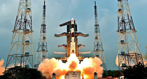
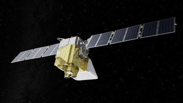
Remote Sensing and
GIS
Remote Sensing

“Climate change affects us
all, but it does not affect us all equally. The poorest and most vulnerable –
those who have done the least to contribute to global warming – are bearing the
brunt of the impact today”
Ban Ki-moon, Secretary General, UN
Remote sensing is the technique of deriving information about objects on
the surface of the earth without physically coming into contact with them. Using various sensors, we collect the data,
process and analyzed it to obtain information about the Earth. The observation
is made on the reflected / scattered or self-emitted electromagnetic energy
from the earth in different wavelength bands.
The reflected / emittance pattern under different spectral /
polarization / temporal etc. conditions provides signatures specific to a land
cover class, which forms the basis for data interpretation. The observations
are synoptic, provide repetitive coverage of large areas and the data is
quantifiable.
Remote
sensing data can be interpreted by digitally in computer through various remote
sensing softwares.
Remote Sensing & GIS study carried out in the areas of
-
·
Agriculture production assessment
·
Land use and land cover
analysis
·
Forest and vegetation
·
Soils and regional
degradation
·
Urban and regional planning
·
Water resources management
·
Geosciences & Groundwater
·
Ocean and atmosphere study
·
Cyclone and flood disaster
management
·
Agriculture
drought monitoring and assessment
·
Landslide, earthquake and
active fault delineation
·
Forest fire monitoring
Geographical Information Systems

A
GIS can be defined as a system which facilitates the storage and intelligent
use of geographic data that is data about land and water resources and human
activities.
The essential features of GIS are the
use of sophisticated computer hardware and software to collect, store,
manipulate and process for geographic data.
Geographic information systems are
tools that allow for the processing of spatial data into information, generally
information filed explicitly to and used to make decisions about some portion
of the earth.
Thus
GIS is in organized collection of computer hardware, software, geographic data
and personnel designed to efficiently
capture, store, update, manipulate analyze and display all forms of
geographically referenced information.
For
GIS study there are several softwares which have been using for geographic data
processing, editing, manipulation, management, analysis, display and output of
geographic information, some analysis tools includes:
·
Topographic map overlays
·
Buffer generation
·
Proximity analysis
·
Spatial and logical query
·
Hydrologic modeling
·
Surface analysis
·
Network analysis
·
Network modeling
·
Raster modeling
·
Sophisticated tabular analysis etc.
Land Use study in the Level I, II & III carried out
in our organization
Global Positioning System (GPS)

GPS
is primarily a navigation system for real time positioning. However, with the transformation from the
ground to ground survey measurements to ground to space measurement made
possible by GPS. With the
well-established high accuracy achievable with GPS in positioning of points
separated by a few hundred of meters to a few thousand of kilometers, this
unique surveying technique has several important applications in many fields.
The
NAVSTAR GPS (NAVigation System with Time And Ranging Global Positioning System)
is a satellite based radio navigation system providing precise three –dimensional
position, navigation and time information to suitably equipped users. The
system is continuously available on a worldwide basis and i
Now a
days GPS is powerful surveying tool which can provide either on its own or in
combination with other ground survey technique the required speed, accuracy and
economy in large scale surveying.
Photogrammetry Study

“Without habitat, there is
no wildlife, It’s that simple”
-Wildlife Habitat Canada
The photogrammetry deals with the
geometrical aspects of aerial photographs and includes the science of obtaining
reliable measurements by means of quantitative study of the aerial photographs.
Aerial
photography is defined as the science of making photographs from the air, for
studying the surface of

Rainwater Harvesting

“We never know the worth
of water till the well is dry”
Thomas Fuller, an English historian
Rainwater
harvesting is the techniques of collection and storage of rainwater at surface
or in sub-surface aquifer, before it is lost as surface run off. The augmented resource can be harvested in
the time need. Artificial recharge to groundwater is a process by which the
groundwater reservoir is augmented at a rate exceeding that under natural
conditions of replenishment.
Methods & Techniques

The
methods of groundwater recharge for urban and rural areas are:
In
urban areas roof top rainwater / storm run-off harvesting through
1.
Recharge
pits 2. Recharge trench 3. Tube well / Borewell 4. Recharge well
In
rural areas rainwater harvesting through
1. Gully plug 2. Contour bund 3.
Gabian structure 4. Percolation tank 5. Check dam / Cement plug / Nala bund 6.
Recharge shaft 7. Dugwell recharge 8. Groundwater dams / subsurface dyke.
Watershed Management Study

Rivers
originate in streams that flow down mountains and hill slopes. A group of small
streams flow down hillsides to meet larger streams in the valley which forms
the tributaries of major rivers. The
management of a single unit of land with its water drainage system is called
watershed management. It is a technique that has several components. This includes
soil and water management and developing vegetative cover. The natural drainage
pattern of a watershed unit if managed appropriately can bring about local
prosperity by a year round abundance of water that improves the quality of
human life in the area.
Each watershed
divided into sub - watersheds (10,000 to 50,000 Ha), milli – watersheds (1,000
to 10,000 Ha) and micro - watershed (upto 1,000 Ha).
Watersheds form the most appropriate
functional landscape units that can be used to determine the dynamic
interactions between land use activities and water resources. Land use
activities such as forestry, mining, agriculture, urbanization, fisheries and recreation
all impact water resources to various degrees. Interactions between natural and
human induced processes can best be assessed in a watershed context because the
water quantity and quality at the outlet of a watershed provides an excellent
indication of how well we manage the resources in it, and what the cumulative
impacts are of all these activities. Water resource problems are reaching
global proportions and given the complexity of all the processes that affect
the hydrological cycle
Computer Simulation & Modeling

Computer
Simulation and Modeling for various studies
·
Remote Sensing analysis –
Remote Sensing Software
·
GIS analysis –GIS software with Extensions
·
Sewer Modeling - HydroWorks
·
Groundwater Modeling –MODFLOW
·
Litho-log & Cross-section - Rockworks
·
Geochemical Model - Surfer
Renewal energy sources & proposed
site selection study

“Because
we are now running out of gas and oil, we must prepare quickly for a third
change to strict conservation and to the use of coal and permanent renewal
energy sources, like solar power”
Jimmy
Carter, an American Politician
sunlight, wind, rain, tides, waves and geothermal heat, which are renewable because they are naturally replenished at a constant rate. New
renewables energy like small hydro, modern biomass, wind, solar, geothermal,
and biofuels are growing very rapidly.
Environmental Studies
EIA Study

“Green building is not
about building, it is about people”
Sandy Wiggins, U. S. Green Building
Council President
The Environmental
Impact Assessment Service offered by us is an ideal tool to analyze the effect
of any project on the society and the environment. Incorporated in these
services is the detailed study of various kinds of effects that an ecological
protection system has or can possibly have on the environment. Known for
reliability and accuracy, the results of these studies allow companies to
rethink their business strategies and revamp their setup by making it more
eco-friendly. We offer these services with geologist, hydrogeologist &
environmental experts with proven academic and professional credentials and
ensure its comprehensive nature.
For
all development projects, whether Government or Private, the MoEF requires an
impact assessment done by a competent organisation. The EIA must look into
physical, biological and social parameters. EIAs are expected to indicate what
the likely impacts could be if the project is
passed.
The Ministry of Environment and Forests (MoEF) has identified a large number of
projects that need clearance on environmental grounds. The EIA must define what
impact it would have on water, soil and air. It also requires that a list of
flora and fauna identified in the region is documented and to specify if there
are any endangered species whose habitat or life could be adversely affected.
Most development projects such as industries, roads, railways and dams may also
affect the lives of local people. This must be addressed in the EIA. There are 40
different industries listed by MoEF that require a clearance before they are
set up.
Other Environmental studies


- Environmental
(monitoring, management, policy analysis, impact studies, risk analysis,
carrying – capacity, systems designs, modeling & optimization,
resettlement and rehabilitation, and biodiversity) study for various EIA
Projects
- Consent to
Operate (for renewal, grant & establish) and Compliance for EIA of
Irrigation, Mining, Power Plant, Cement, Steel, Paper & Textiles
industries
- Preparing
presentation for term of reference (TOR) & Environmental Clearance
(EC) for EIA Projects at SEAC and MoEF
- Writing
& editing EIA, EMP & Feasibility Study reports.
Disaster Management

“Without habitat, there is
no wildlife, It’s that simple”
-Wildlife Habitat Canada
The Indian subcontinent is very vulnerable to droughts, floods,
cyclones, earthquakes, landslides, avalanches and forest fires. Among the 36
states and Union territories in the country, 22 are prone to disasters. Among
all the disasters that occur in the country, floods are the most frequently
occurring natural disasters, due to the irregularities of the Indian monsoon.
About 75 percent of the annual rainfall in India is concentrated in three to
four months of the monsoon season. As a result there is a very heavy discharge
from the rivers during this period causing widespread floods. Approximately 40
million hectares of land in the country has been identified as being prone to
floods. Major floods are mainly caused in the Ganga-Brahmaputra-Meghna basin
which carries 60 percent of the total river flow of our country.
India
has a long coastline of 5700 kms, which is exposed to tropical cyclones
arising in the Bay of Bengal

Droughts are a perennial
feature in some states of India. Sixteen percent of the country’s total area is
drought prone. Drought is a significant environmental problem as it is caused
by a lower than average rainfall over a long period of time. Most of the
drought prone areas identified by the Government lie in the arid and semi-arid
areas of the country.
Earthquakes are
considered to be one of the most destructive natural hazards. The impact of
this phenomenon occurs with so little warning that it is almost impossible to
make preparations against damages and collapse of buildings.
About
50 to 60 percent of India is vulnerable to seismic activity of varying intensities. Most of the vulnerable areas are located
in the Himalayan and sub-Himalayan regions.
Disaster
management is a multidisciplinary
area in which a wide range of issues that range from forecasting, warning,
evacuation, search and rescue, relief, reconstruction and rehabilitation are
included. It is also multi-sectoral as it involves administrators, scientists,
planners, volunteers and communities. These roles and activities span the
pre-disaster, during disaster and post disaster plans. Since their activities
are complementary as well as supplementary to each other there is a critical
need for coordinating these activities.
Medical geology study

“Earth provides enough to
satisfy every man’s need, but not every man’s greed”
Mahatma Gandhi
Is the science dealing
with the relationship between natural geological factors and health in humans
and animals understanding the influence of ordinary environmental factors on
the geographical distribution of such health problems, if is an complicated.
The field
medical geology brings together geoscientist and medical and public health
researcher to address health problems caused or exacerbated by geologic
materials such as rocks, minerals and water and geologic processes such as
volcanic eruptions, earthquake and dust.
Environmental Education and Training

“ The best time to plant a
tree was 20 years ago”
A Chinese proverb
Environmental education deals with
every issue that affects an organism. It is essentially a multidisciplinary
approach that brings about an appreciation of our natural world and human
impacts on its integrity. It is an applied science as its seeks practical
answers to making human civilization sustainable on the earth’s finite
resources.
Its
components include biology, geology, chemistry, physics, engineering,
sociology, health, anthropology, economics, statistics, computers and
philosophy.
Environment
is not a single subject. It is an integration of several subjects that include
both Science and Social Studies. To understand all the different aspects of our
environment we need to understand biology, chemistry, physics, geography,
resource management, economics and population issues. Thus the scope of
environmental education is extremely wide and covers some aspects of nearly
every major discipline.
We
live in a world in which natural resources are limited. Water, air, soil,
minerals, oil, the products we get from forests, grasslands, oceans and from
agriculture and livestock, are all a part of our life support systems. Without
them, life itself would be impossible. As we keep increasing in numbers and the
quantity of resources each of us uses also increases, the earth’s resource base
must inevitably shrink. The earth cannot be expected to sustain this expanding
level of utilization of resources. Added to this is misuse of resources. We
waste or pollute large amounts of nature’s clean water; we create more and more
material like plastic that we discard after a single use; and we
waste colossal amounts of food, which is discarded as garbage. Manufacturing
processes create solid waste byproducts that are discarded, as well as
chemicals that flow out as liquid waste and pollute water, and gases that
pollute the air. Increasing amounts of waste cannot be managed by natural
processes. These accumulate in our environment, leading to a variety of
diseases and other adverse environmental impacts now seriously affecting all
our lives. Air pollution leads to respiratory diseases, water pollution to
gastro-intestinal diseases, and many pollutants are known to cause cancer.
Improving
this situation will only happen if each of us begins to take actions in our
daily lives that will help preserve our environmental resources. We cannot
expect Governments alone to manage the safeguarding of the environment, nor can
we expect other people to prevent environmental damage. We need to do it
ourselves. It is a responsibility that each of us must take on as ones own.
The consultancy provides education to
the school and college students through modern teaching aids.
Environmental Calendar

There
are several days of special environmental significant which can be celebrated
in the community and can be used for creating environmental awareness.
February
2: World Wetland Day is celebrated to create awareness about wetlands and their value
to mankind. On February 2nd 1971, the Ramsar Convention on Wetlands of
International importance was signed at Ramsar in Iran. You can initiate a
campaign for proper use and maintenance of wetlands in the vicinity of the city
or village.
March
21: World Forestry Day can be used to initiate a public
awareness campaign about the extremely rapid disappearance of our forests. The
program must be action oriented and become an ongoing process with activities
such as tree plantation.
April
7: World Health Day – The World Health Organisation (WHO)
came into existence on this day in 1948. A campaign for personal sanitation and
hygiene to understanding issues of public health, occupational health, etc. can
be carried out. Topics that deal with environment related diseases and their
spread can be discussed and preventive measures suggested.
April
18: World Heritage Day can be used to arrange a visit to a
local fort or museum. Environment also includes our cultural monuments.
Students could use this opportunity to create awareness among the local people
about their very valuable heritage sites.
April 22: Earth Day was
first celebrated in 1970 by a group of people in the USA to draw attention to
increasing environmental problems caused by humans on earth. This day is now
celebrated all over the world with rallies, festivals, clean-ups, special shows
and lectures.
June
5: World Environment Day marks the anniversary of the Stockholm
Conference on Human Environment in Sweden in 1972, where nations of the world
gathered to share their concern over human progress at the expense of the
environment. This day can be used to project the various environmental
activities that the college has undertaken during the year. New pledges must be
made to strengthen an environmental movement at the college level.
June
11: World Population Day is a day when the vital link between
population and environment could be discussed in seminars held at college and
other NGOs.
August
6: Hiroshima Day could be used to discuss our own Bhopal Gas Tragedy and the
Chernobyl disaster.
September
16: World Ozone Day was proclaimed by the United Nations as the International Day
for the preservation of the ozone layer. This is a good occasion for students
to find out more about the threats to this layer and initiate discussion on
what they can do to help mitigate this global threat. The day marks the
Montreal Protocol signed in 1987 to control production and consumption of ozone
depleting substances.
September
28: Green Consumer Day could be used to create awareness in
consumers about various products. Students could talk to shopkeepers and
consumers about excess packaging and a campaign to use articles which are not
heavily packaged could be carried out.
October
1-7: Wildlife Week can consist of seminars on conserving our species and threatened
ecosystems. The State forest Departments organize various activities in which
every student should take part. A poster display, a street play to highlight
India’s rich biodiversity can be planned. Wildlife does not only mean animals,
but includes plants as well.
Other Important Days
30 January :
National cleanliness day
02 February:
World wetland day
21 March :
World forestry day
22 March :
World water day
31 March :
Earth hour
07 April :
World health day
18 April :
World heritage day
22 April :
Earth day
08 – 09 April :
World migratory bird day
22 May :
International day for biological diversity
23 May :
World turtle day
05 June :
World environment day
08 June :
World oceans day
15 June :
Global wind day
17 June :
World day to combat desertification and drought
11 July :
World population day
28 July :
World nature conservation day
29 July :
Global tiger day
12 Aug :
International youth day
21-27 August :
World water week
16 September :
International day for preservation of ozone layer
18 September :
World water monitoring day
21 September :
Zero emission day
22 September :
World car free day
28 September :
Green consumer day
1-7 October :
World wildlife week
10 October :
World habitat day
04 October :
World animal welfare day
13 October :
International day for natural disaster reduction
06 October :
World food day
10 November
:International day for preventing the exploitation of the environment in war
and armed conflict
21 November :
World fisheries day
02 December :
National pollution prevention day
05 December :
World soil day
10 December :
World human right day
11 December :
International mountain day
14 December :
National energy conservation day
Contact:
Address:

Mr. Bhushan O. Kachawe
Founder & CEO
Founder & CEO
Geomatrix Envirotech Solutions
(Environment * Water * GIS)
Office: B2, 23/7, Sector 16, Modern College road, Near Vashi Fire Station, Vashi, Navi Mumbai, MS., INDIA(Environment * Water * GIS)
bhushankachawe@gmail.com
Cell: 8055365201, 9619239669, 9619235923
Website : www.geomatrixenvirotech.com
I just want to thank you for sharing your information and your site or blog this is simple but nice Information I’ve ever seen i like it i learn something today. Geology Consulting Companies
ReplyDelete